
Sponsored by Wood County Park District
by LeMoyne Mercer
RECENTLY I WAS ranting about the ever-increasing crowds in our national parks. Attendance records have been set every year since COVID even in places you never heard of. Park trails that used to offer quiet solitude now have much higher foot traffic. Is this a good thing? Who am I to complain? I’ve been pushing a walk in the park for nearly 30 years but never dreamed that so many millions of you were paying attention. Okay, maybe 25 or 30 of you.
Though the number of hikers has increased, most national park visitors still do not venture far from their vehicles. There is actually no need to because there are pullouts on almost all park roads that provide ample opportunities for admiring the grandeur of our country. Sightseeing this way avoids the inconvenience of getting dusty and sweaty or the risk of unpleasant encounters with lions and tigers and bears. Oh my!
With that said, there are aptly named Quiet Walkways in the Smokies that go a short distance into the forest where it is amazingly peaceful. Stretches of the 2,198-mile-long Appalachian Trail seem to attract walkers who go just far enough to get a selfie with an AT sign at the first juncture. Some trails, though, require significant levels of commitment, fitness, and courage. Angels Landing in Zion, for example, goes where even angels fear to tread. Angels can fly. So will you if you don’t hang on tight to the chains attached to the cliff face.
Hikes that create long-lasting memories tend to have special attributes— depending on how you define that. Here are just three of ours.
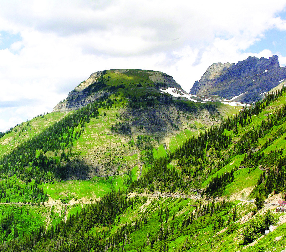
Mt. Washburn
We made our first family trip to Yellowstone in 1985. Like the rest of the world, we were blown away by the wildlife, thermal features, and mountain scenery. Naturally, we went to Old Faithful, the Lower Falls of the Yellowstone, and into Hayden Valley and Lamar Valley to see herds of bison, elk, and pronghorns. Moose along the river. An occasional bear.
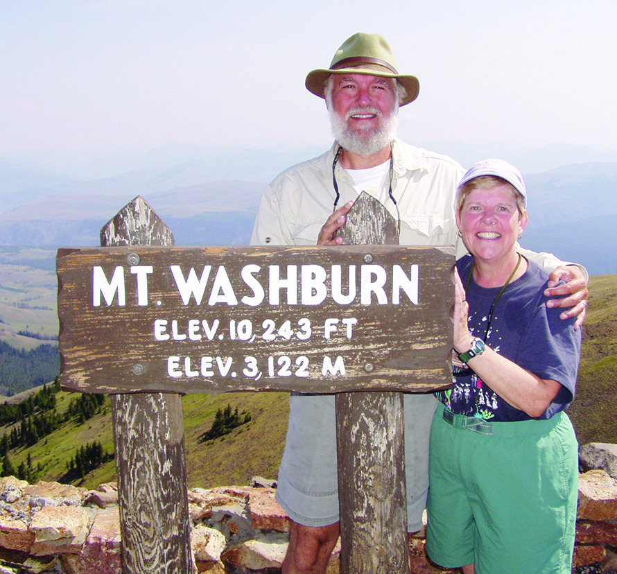
One of the highlights of that trip, and on several return visits, was the hike to the summit of 10,243-ft. Mt. Washburn. The elevation is important because the air is thinner up there and much cooler even in mid-summer. Most of Yellowstone is above 8,000 feet, so your body needs a couple days to adjust to the elevation before you undertake anything strenuous.
At the Dunraven Pass trailhead, there were great meadows of golden wildflowers. It is best to get started early in the morning. First, you want to beat the crowds, but, more importantly, you want to beat the prospect of afternoon thunderstorms with lightning as the sun-warmed air rises up the slope. In addition, it can snow any day of the year in Yellowstone and the risk increases with the elevation. The Park Service advises against going up there in September and October when the grizzlies are packing on weight for their long winter nap.
In ’85, the trail above the treeline was filled with slush where it passed between shoulder-high snow banks. We had wool shirts, waterproof boots, and jackets. As we neared the ranger fire tower, we met a young woman coming down. She wore a short skirt, a sweater tied around her shoulders, and open-toed wooden clogs. The obvious lesson was that only wimps really need boots and coats.
The stone ranger tower has a viewing deck from which, on clear days, you can see the Grand Canyon of the Yellowstone River and even the Tetons about 50 miles to the south. Rangers keep track of wildfires, most of which are small and burn themselves out naturally. A disastrous fire in 1988, though, burned 480,000 acres and came very near to getting the Yellowstone Inn. Snow on Sept. 11 quenched the fire.
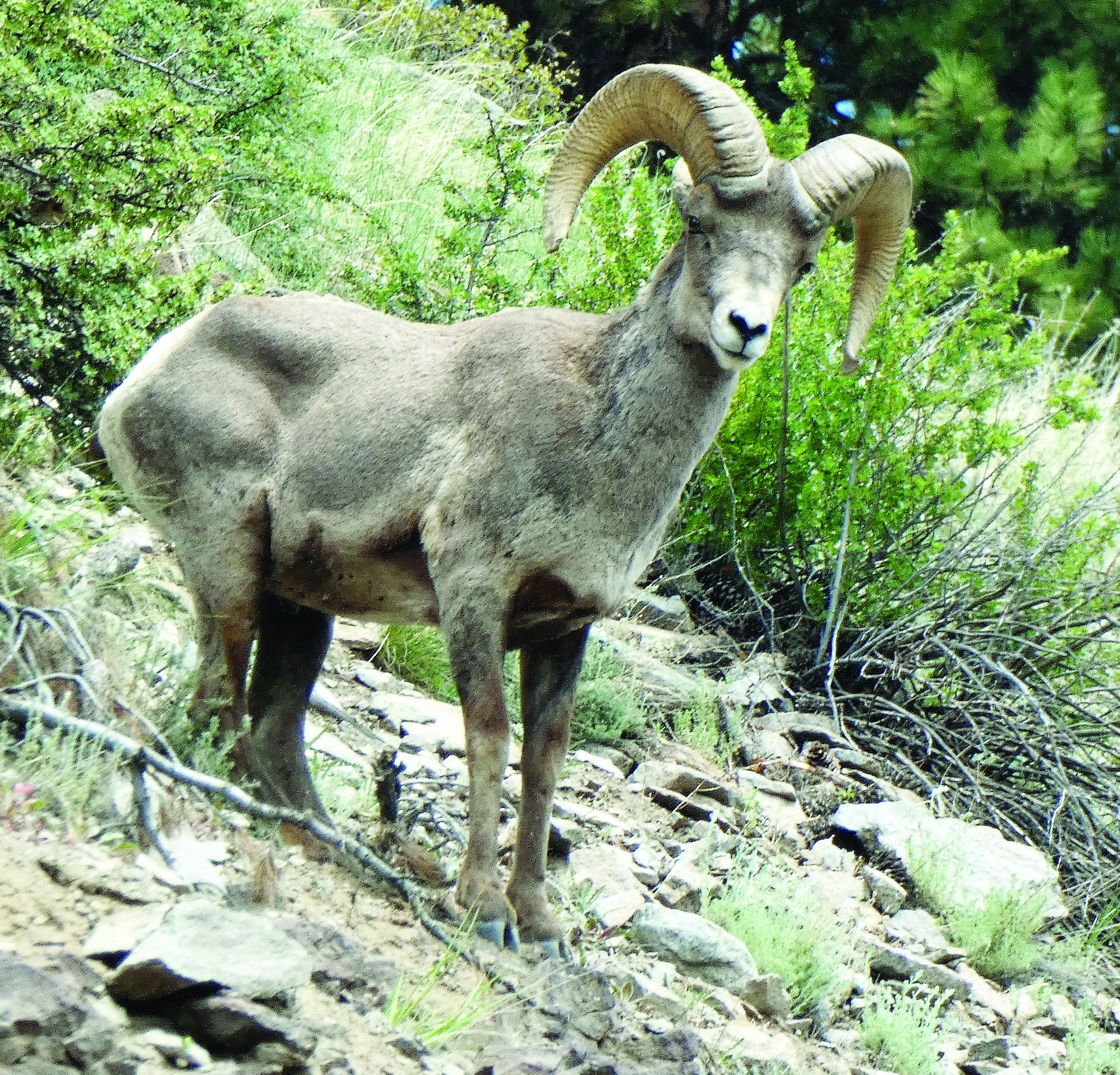
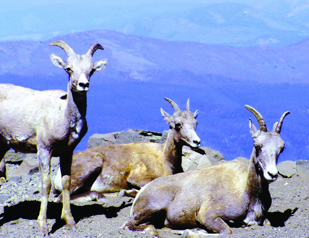
Though we have never met bears on Mt. Washburn, we do count on meeting herds of bighorn sheep feeding in the meadows. Ewes like to plop down right in the trail to chew their cud while lambs practice their climbing skills by chasing each other along the rocky slopes. It is a special treat to encounter them up close.
Granite Park Chalet
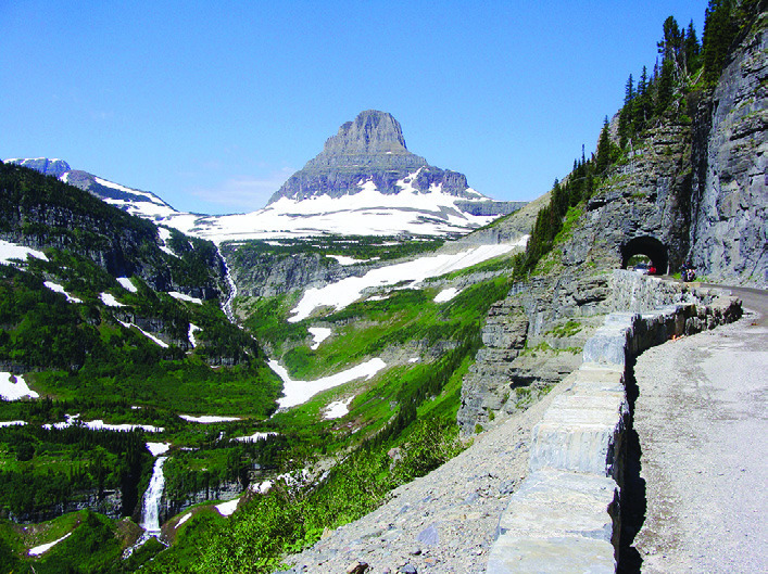
Logan Pass in Glacier NP, in northwestern Montana, is the half-way point on Going-to-the-Sun Road. Along the road is absolutely spectacular scenery: snow-capped mountains, towering water falls fed by snow melt, tumbling mountain streams, alpine lakes, tundra wildflowers. At the Pass, tourists with binoculars admire bighorn sheep and mountain goats cavorting on sheer cliffs a half mile away. The sheep (brown with curly horns) and goats (white with spikey horns) can be encountered up close if, as on Washburn, you are willing to walk even a surprisingly short distance.
We decided to take our lunch and head out the Highline Trail to find a rock on which to enjoy the view. The narrow trail is carved into the face of a sheer cliff called the Garden Wall where the whole world was spread out before us. As we were finishing lunch, hikers approached from the opposite direction. “Granite Park Chalet is wonderful!” they said. “You can’t stop now. You’re half way there.” The walk to that point had not been particularly challenging, so we decided to spend another hour or so of our afternoon strolling out to the chalet.
In another hour or so, we met more hikers. “Granite Park Chalet is wonderful!” they said. “You can’t stop now. You’re half way there.” By then we had invested too much effort to give up without getting the promised reward.
Eventually we rounded a curve and saw the chalet perched on a promontory only about a quarter mile away—as the crow flies. There was a deep, steeply walled mountain valley between us and our destination. The trail looped around to the end of the valley and doubled back. Having come within sight, we couldn’t stop now.
At the chalet, we shared a pitcher of lemonade and a couple peanut butter cookies on the front porch. As promised, it was wonderful. If I were honest with you, which sometimes I am, I would admit that the view was no more wonderful than anything we had seen back at Logan Pass. Even so, we would have spent more time appreciating the view, but it was already late afternoon. At the chalet, we were quite literally half way through the hike and had to walk the other half back to the pass.
Still, there were memorable moments along the way. At a bend in the trail, we came face-to-face with a herd of bighorn sheep led by a large ram. We stared at each other for a few seconds before he politely led his herd up the side of the mountain to allow us to pass before descending back to the trail. Later on, a mountain goat peered down at us from his perch on a rock outcropping.
At dusk, we had reached the place we had stopped for lunch, so we knew that we were once again “half way there.” We had not bothered to take our topographic trail map because we never intended to go as far as the chalet. Consulting the map later, we found that Granite Park Chalet is 7.5 miles. So, 15 miles total. Fifteen mountain miles. You would not be the first person to wonder why Shirley puts up with this stuff. That includes, of course, Shirley herself who thinks “happy trails” are sometimes best appreciated from the vantage point of a couple decades. She still uses “You can’t stop now” as code for “You better stop now!”
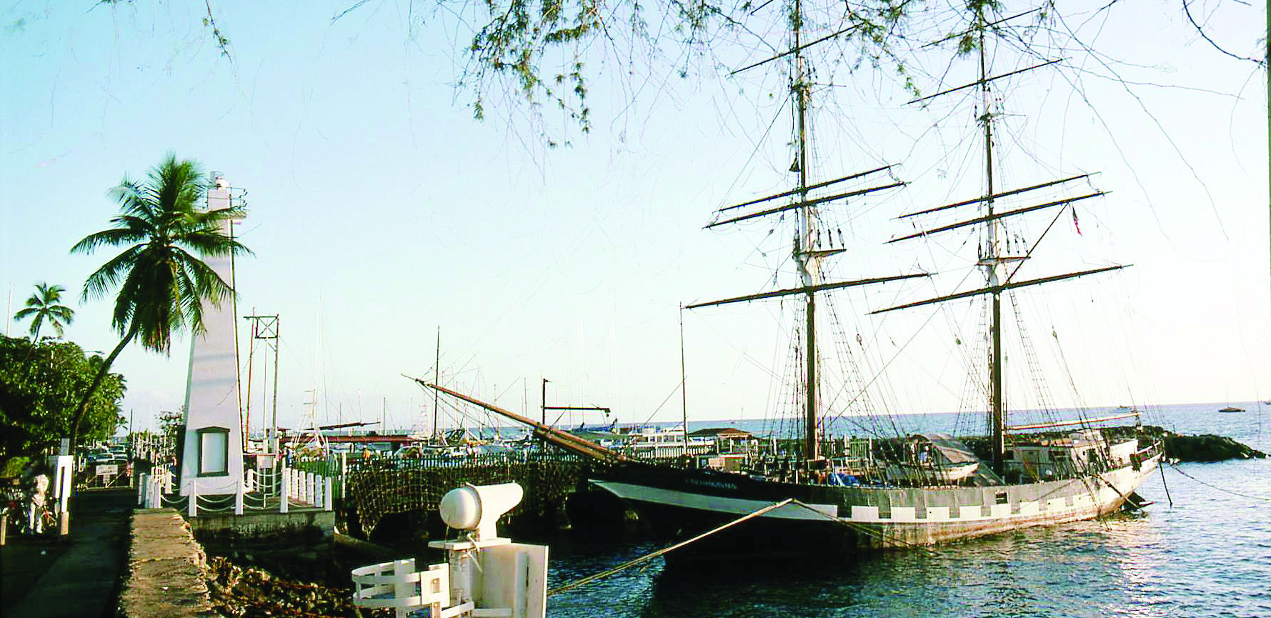
With that said, Shirley and I do have fond memories of two visits to Lahaina, Maui. We stayed in the Historic District that was completely destroyed by wildfires last August. The purpose here, though, is to focus on memorable trails, not on disaster.
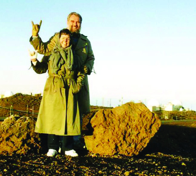
“Haleakala” means “House of the Sun,” and sunrise at the summit of Mt. Haleakala is one of the highlights of any visit to Maui. There are several things to consider before you go. They seem obvious when you think about them. Some of us, guys mostly, are prone to thinking only when all else has failed.
• What time exactly is sunrise up there? Morning light touches mountain peaks earlier than lower places.
• What is the weather expected at that time? The peak is often wrapped in clouds that obscure the view.
• How long will it take to get there? It is 37 miles from Kahului to the summit. Can you do 37 miles in an hour?
How about an hour and a half?
When was the last time you drove from sea level to 10,023 ft. on a narrow, steep, winding mountain road in the dark in an unfamiliar rental car?
The drive makes the greatest elevation gain over the shortest distance in the world.
• How should you dress? At 10,000 ft., it is often windy and below freezing even in a tropical paradise. You definitely won’t be happy in shorts and a T-shirt. From Haleakala you can see Mauna Kea where there is skiing—the snow kind.
• For the 3:00 a.m. to 7:00 a.m. sunrise window you can now make reservations up to 60 days in advance. Tickets are only $1. If the weather doesn’t cooperate, the loss of a buck probably won’t ruin you. The parking lot up there is small and closes when it is full.
Reservations help control the size of the crowd. On our first trip to Haleakala, we got up at 3:30 to call the weather hotline. The forecast called for clear. We arrived at 6:00 for the 6:57 sunrise. It was below freezing, but we had taken our Ohio coats with us. Some visitors sat in their cars with the engines running to stay warm. In the wolf-gray predawn light, we could see that, as promised, the sky was clear. But there were plenty of clouds down in the caldera, so we ended up watching the sunrise from above the clouds. The sun appeared first as a thin sliver of red and gold then, suddenly, the whole ball popped up like Jack-in-the-box. The “mountains” in the east turned out to be the ragged edge of the far rim of the volcano.
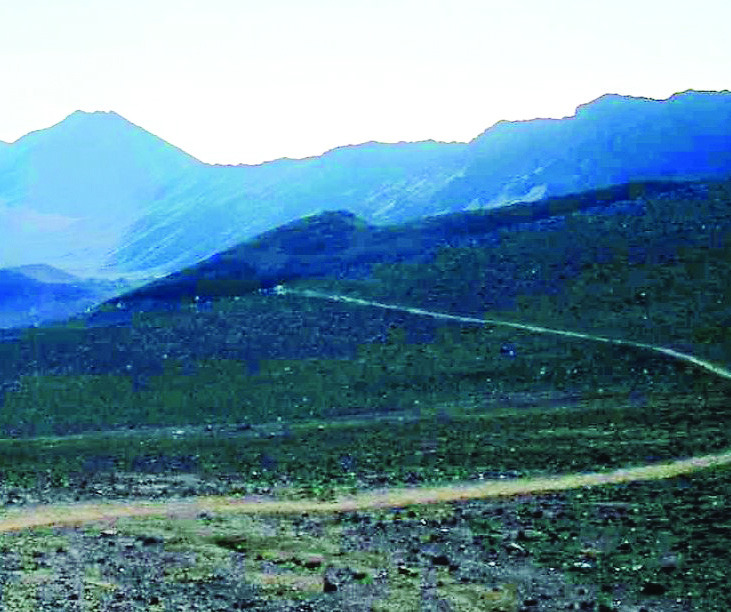
As the sky turned vivid blue and the temperature rose, we headed down into the caldera on the Sliding Sands Trail. There were old footprints still filled with frost. The trail descends 500 ft, about a 50-story building, in a mile or so as it passes numerous cinder cones. Minerals tossed up during eruptions account for the red, black, orange, and yellow sand. The climb back out explains the Sliding Sands name of the trail. In addition to the stress related to the elevation, as with Mt. Washburn of similar height, there was also the nature of the footing. It takes longer than you might think when climbing two steps up and sliding one step back down. Sometimes two or three back for one up.
On our second trip, the road was closed by wind and ice above 7,000 ft., so we waited two days, using that time for other touristy activities. When we got the all clear, we headed up the road at 4:30 and arrived at 6:15 for the 6:30 sunrise, cutting it somewhat closer than Shirley would have liked.
A small crowd stood along the rim in reverent expectation. The exultant melody of Richard Strauss’s
was playing inside my head as the sun rose slowly. Then the guy on my right dramatically proclaimed in his best Ted Baxter voice, “Ah! The dawn of a new day!” That sort of broke the spell. Still, in the crisp, clear light we could see the peaks of Mauna Loa and Mauna Kea on the Big Island as well as the neighboring islands Molokai and Lanai. Closer up were the West Maui Mountains across the narrow isthmus that joins the two parts of the island. Just lovely.
On the opposite side of the country is another sunrise experience. The crest of Cadillac Mountain in Maine’s Acadia National Park is the very first place in the U.S. touched by the rays of the sun. You can’t drive up there, so the sunrise hike of a couple miles must be made over bare granite by following rock cairns in total darkness. Between Cadillac and Haleakala are thousands of other mostly happy trails where you can create lifetime memories by taking a walk in the park.
LeMoyne Mercer is the travel editor for Healthy Living News. You might want to see more of his stories and photos at AnotherWalkinthePark.blogspot.com. ✲