


LAST MONTH, WE COVERED the route Shirley and I prefer when RVing to Alaska: through Grand Teton and Yellowstone National Parks, the Canadian national parks Kootenay, Yoho, Banff, and Jasper, to the start of the Alaska Highway at Dawson Creek, British Columbia. From there, the Highway continues 1,400 miles to Alaska. Then what? There are not many choices. Though Alaska is by far the biggest state, it is still mostly roadless wilderness accessible only by boat or plane. That includes even Juneau, the state capitol.
Kim and John wanted to know where to go in Alaska. The short answer is wherever the paved road goes and a few places where it is not paved. We prefer the counter-clockwise loop up to Fairbanks, down through Anchorage to Homer on the west side of the Kenai Peninsula, over to Seward on the east side, back through Anchorage to Valdez, closing the loop back up at Tok, and then out to the Yukon and back into Alaska at Haines and Skagway. There is scenic beauty beyond belief and wildlife up the wazoo. We can’t begin to cover everything worth seeing and doing in the space available here, but we can touch on what we consider some highlights.
First, about the Alaska Highway itself. We were warned that the road is pretty rough. Be prepared to have your windshield broken by flying gravel. They were right. Our windshield did get broken—in North Platte, Nebraska. For the most part, the Alaska Highway is in pretty good shape, but watch for orange cones or little red flags at the side of the road that mark places where there are frost heaves. Water that freezes and expands beneath asphalt pushes it up to create natural speed bumps.
A surprisingly popular tourist attraction is the Sign Post Forest at Watson Lake, Yukon. During construction of the Highway in 1942, Private Carl Lindley was sent to repair some road signs. While he was at it, he added one for his hometown: Danville, Illinois 2,835 miles. In 1992, Lindley and his wife Elinor marked the 50th anniversary of the road by renewing his sign. Soon, travelers from all over the world began bringing or making their own signs until there were more than 80,000 on about two acres. Stop to see if you recognize any of sign posters.
Near Watson Lake, we met two men from San Diego at a scenic pullout on the Highway. They said they were headed to Anchorage where they had taken jobs with a fishing company. Now, if you are at Watson Lake on your way to Anchorage, it means only one thing: you have driven four hours in the wrong direction. Perhaps they should have paid more attention to the sign posts at Whitehorse when they turned east instead of west.
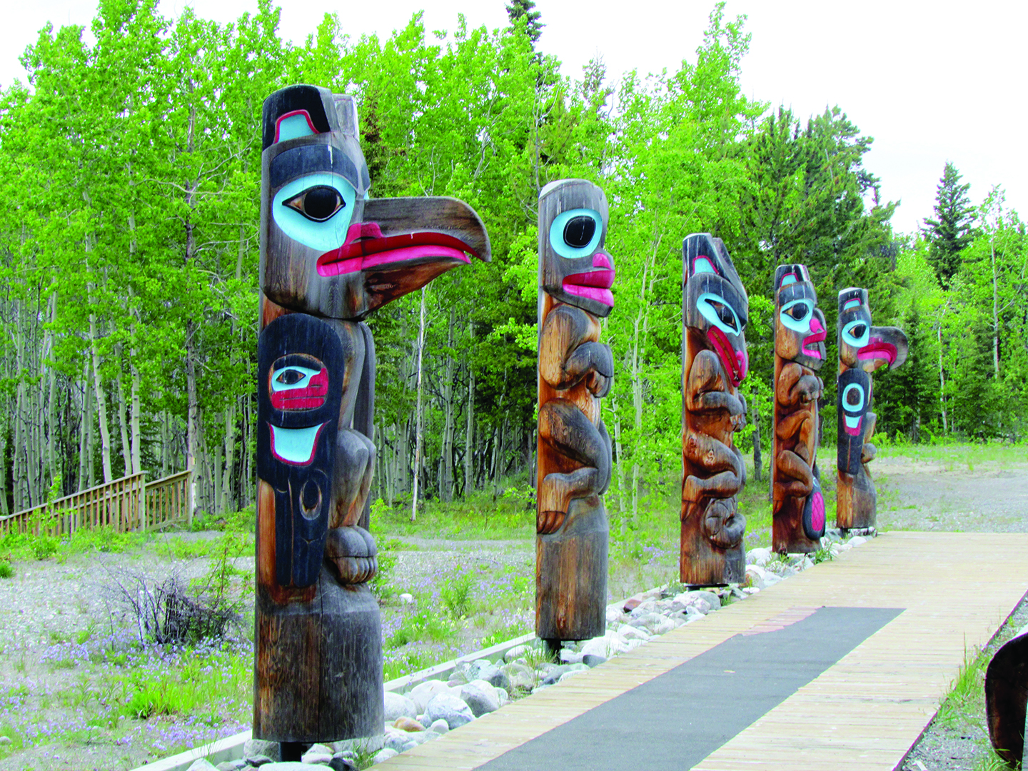
When retracing their steps, they probably didn’t have time to stop at the Tlingit (pronounced Kling-it) Heritage Center. The Tlingits were once a coastal people but moved inland for a more plentiful supply of furs to trade with the Russians and Americans. The Heritage Center holds demonstrations of crafts and a museum featuring ceremonial masks, decorated leather, beadwork, and wood carvings including totem poles. The staff is very friendly and proud to talk about their way of life. Taste some bannock or Indian fry bread. The authentic kind was fried in moose or bear grease, but the contemporary variety acknowledges the reluctance of squeamish Americans by using vegetable oil.
The next stop is Whitehorse where we hope the San Diego boys were paying closer attention to the signs at the fork in the road. The Whitehorse Walmart used to be the most popular “campground” in all of the Yukon because they welcomed RVers to park for the night. Most of us showed our appreciation by restocking our pantries and leaving early the next morning. Some, however, overstayed their welcome by using the parking lot as a storage facility, so management no longer permits it.
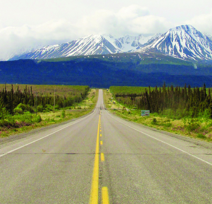
The Alaska Highway winds along the base of the mountains with Kluane (Clue-on-ee) National Park on the left and Lake Kluane on the right. There is not much point in telling you the scenery is spectacular because that could be said of any mile chosen at random. It is only 278 miles from Whitehorse to the US border near Beaver Creek.
On the recommendation of fellow RVers, we stopped at a small meat market in Delta Jct., AK for some buffalo sausages and reindeer Polish sausage. They were a little gamey, but that was the point, I suppose. Besides, those with inclinations toward pedantry would argue that buffalo is really bison and reindeer is really caribou. Marketing often takes precedence over taxonomic accuracy.
north pole, North Pole, AK where there is a lot of business at the post office just before Christmas. The little town is easy to find because of the huge Santa Claus. You might want to stop there for gifts to impress the kids with the claim that they came directly from North Pole.
Next stop is Denali National Park, for many travelers the primary destination in Alaska. Like everybody else, our goal was to see The Mountain, at 20,322 ft. the highest in North America. But it was overcast because Denali is so big it generates its own weather patterns and about 70% of the time is wrapped in clouds. As RVers, we had the luxury of hanging around a few days until the sky was clear. Visitors who arrived on tour buses or took the Alaska Railway from their cruise ship generally do not have that option. There is plenty to see and do while waiting: drive out Savage River 15 miles, as far as you are permitted to go, for wildlife viewing; see a dog sled demonstration; do some shopping and dining just outside the park; flightseeing by plane or helicopter. Denali might be socked in, but the sky may be blue elsewhere.
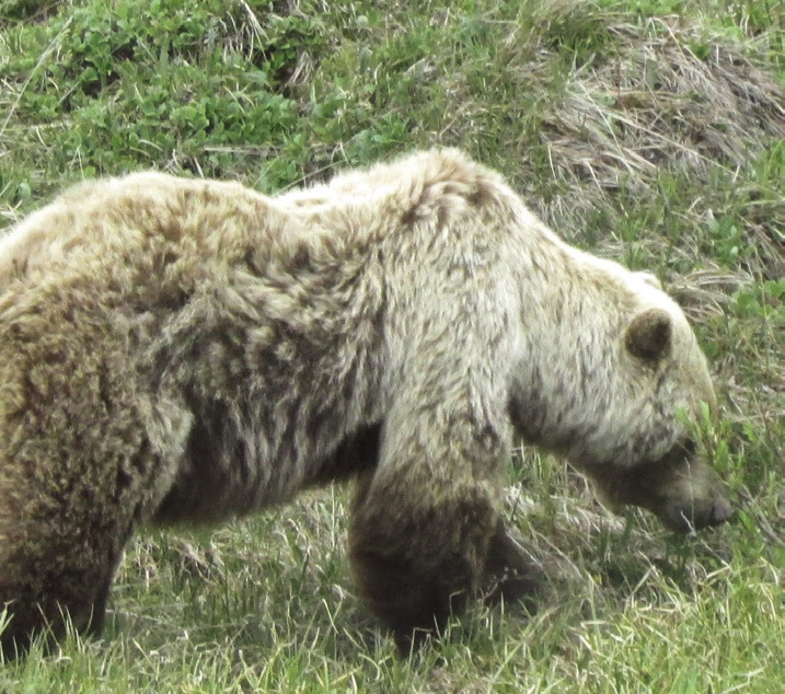
What you’ll experience on the eight-hour bus ride out and back makes it worth the wait. Even if there were no mountain, the bus tour still would be a fabulous adventure. Bears, caribou, moose, foxes, Dall sheep, Stone sheep, ptarmigans, eagles, snowshoe hares... Our driver, Lee Lipscomb, said to sing out if we spotted something. We stopped often. On the way back, Lee said no more stopping unless a herd of caribou was blocking the road. Around the next bend, there they were.
Among the many benefits of RVing is that you get to stop whenever you like. And, in Alaska, you will want to stop a lot and then spend the night in long, wide pullouts on the highways. Some of our best memories are of nights at the base of waterfalls and the toe of glaciers. Traffic tends to be light to begin with, and in the evening it becomes virtually non-existent. If you are a fan of peaceful solitude in the grandeur of a natural setting, it is hard to beat the experience.
South of Anchorage, the road follows the shoreline of Turnagain Arm with mountains rising steeply to your left and a very shallow inlet of the sea to your right. The Arm experiences tidal bores twice a day when the tide comes in. The sea rushes in at more than 20 mph creating waves that can be six feet high. Surf’s up! Alaskan surfers appreciate it as much as Hawaiians even though the water is somewhat nippier. Visitors are cautioned not to go wading out there. The bottom is muddy and can grip your feet tightly. Not a good thing when the bore arrives.
Every small town in the state has a Historic District with some form of quirky characteristic—and quirky characters. In Hope, on the south side of the Arm, Shirley and I walked around the assortment of log cabins while waiting for the volunteer host to arrive and open the museum. She apologized for being late because she had to put some moose meat in the slow cooker. Turns out there is a call-list run by state troopers for people interested in salvaging the carcasses of road-killed moose. There are 800 to 1,000 fatal “moose-vehicle interactions” a year. The trick is to get there quickly and then leave before the bears show up.
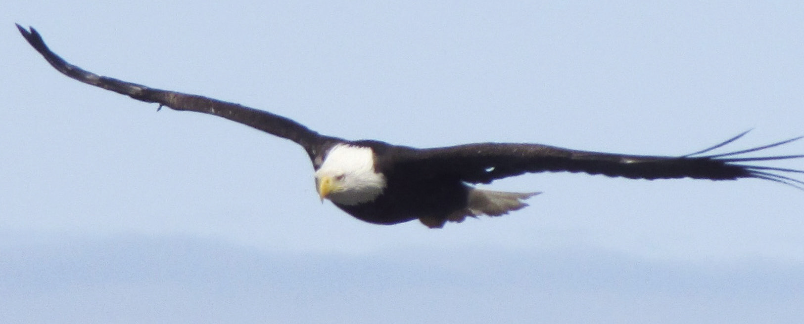
From Hope, it is down the Kenai Peninsula to Homer. Along the way, we pause at AnchorPoint, the western-most place in North America reachable by road. More importantly, there are more eagles than you would believe. There is a nice campground, and those eagles will come to perch right over your picnic table. Be alert for what birds tend to do regardless of species.
Homer is approached from a crest overlooking the town and the Homer Spit, a finger of gravel and sand extending five miles into Katchemak Bay. There are campgrounds on the
Spit, so you can park with the nose of your rig just a couple feet from the water. Homer is famous as a quaint little brewing town ruined by excessive fishing. We are grateful for both those qualities. A new brewery springs up in Homer every two or three days, and the fishing is so good that campground neighbors from Anchorage, who owned a boat, shared 10 pounds of halibut with us. Even in Alaska, halibut was selling for $20 so their generosity was appreciated.
Retracing our steps around the Kenai Peninsula, we come to Seward, Mile 0 of the annual Iditarod dogsled race to Nome through blizzards and horrid windchill. Seward is also home to world-class skiing. There are no chair lifts or gondolas. You reach the summit by helicopter. And on July 4, Seward hosts the annual Marathon Race. This is not 26 miles but to the top of Mt. Marathon and back. We camp at the Seward Waterfront Park on Resurrection Bay where, as in Homer, the sites are right at water’s edge. The Bay is narrow, so you get a good view of fishing boats racing in to be first to market with their catch. Cruise ships pull in and back out of the marina with greater agility than you would expect from such huge vessels. Sea otters float by on their backs, using rocks to crack open clams on their chests.
A better way to see sea otters is by taking a glacier-wildlife day cruise to neighboring Kenai Fjords National Park. There are also cruises out of Whittier to the densest concentration of glaciers in the world. The sea is calmer in this part of Prince William Sound, but there is not as much wildlife. For that, we much prefer a cruise from Valdez where you can see whales doing backflips, seals performing water ballet, and more of those sea otters resting on ice flows as well as Columbia Glacier calving into the sea. A few hundred tons of ice dropping into the water can create quite a wave and 400 square miles of ice can make you wish you had taken your fur-lined parka even in the middle of summer.
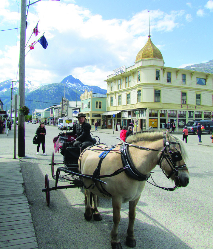
From Valdez, we follow the Tok Cutoff along the edge of Wrangell-St. Elias NP, across the southwest corner of Yukon and back into Alaska to Haines and then out again and around to Skagway. In winter, Haines is a major gathering place for eagles, but in summer, not so much. Skagway was a major jumping off point during the 1896 Klondike Gold Rush to the Yukon. The Royal Canadian Mounted Police blocked entry unless prospectors had at least a ton of supplies each to keep them from starving before they even reached the gold fields. Most climbed the unbelievably steep Chilkoot Trail 20 to 40 times to meet the requirement. It is a difficult climb for hikers carrying simple day packs in summer. Hauling a ton 33 miles through snow, ice and -50-degree weather was proof of exceptional motivation.
Today, visitors arrive by road or cruise ship to a town that has worked hard to preserve at least a superficial resemblance to the Gold Rush days when it was about as wild as any place in the Wild West. Con men, thieves, claim jumpers, card sharks, unscrupulous merchants, gun fighters. In its heyday, there were 80 saloons, three breweries, and too many brothels to count. A good time was had by all.
On the advice of Dorothy and Mary, British Columbia ladies we met in Arizona, Shirley and I went south through B.C. to Bellingham, Washington and then east through North Cascades NP and back to Yellowstone and the Tetons. On our second trip, this route was closed by wild fires so we were forced to detour via the Icefields Parkway. Even though the smoke was like really dense fog even that far east, it was still just a walk in the park.
You might want to visit AnotherWalkinthePark.blogspot. com for posts about these and numerous other destinations. ✲