
-
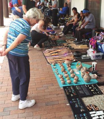 Trade with Indians continues today in the arcade of the Governor’s Palace in Santa Fe. Four-inch clay pots at $350 seemed a little steep, but they are willing to haggle.
 -
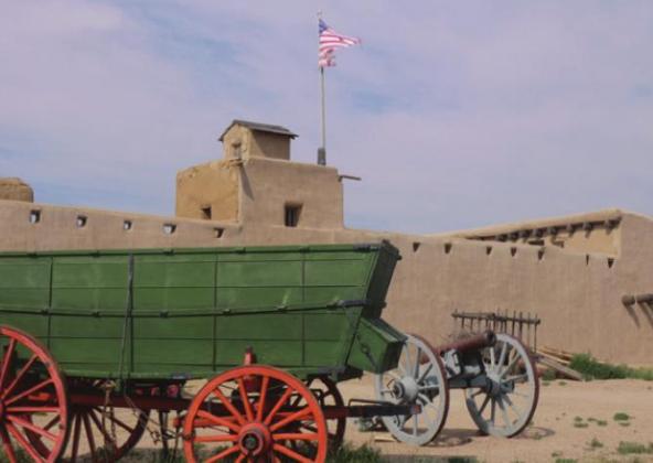 A Conestoga wagon could carry about 2,500 lbs. of freight. It had to be strong but also light enough to not overburden the mules or oxen that pulled it.
 -
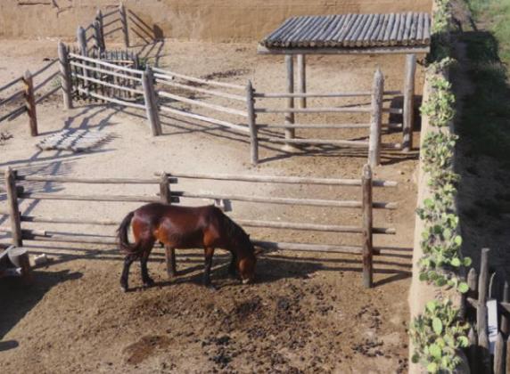 Thorny cactus was planted at the top of the corral to discourage horse thieves. It was the equivalent of barbed wire or razor wire used today.
 -
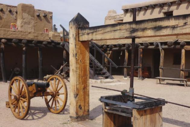 That box with long levers attached was used to compress buffalo hides for more efficient transport.
 -
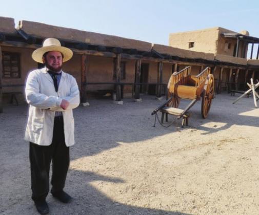 We enjoyed chatting with Austin in his role as a trader at the Fort.
 -
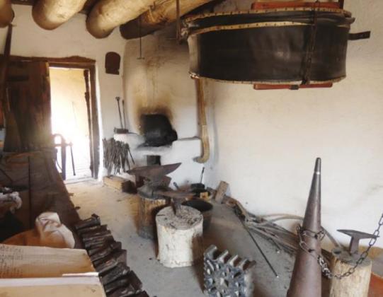 That black disk is the bellows used to fan the flames in the blacksmith’s forge.
 -
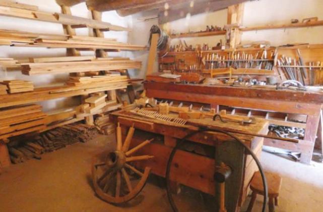 The well-equipped carpenter’s shop was the source of vital repairs for wagons and other equipment.
 -
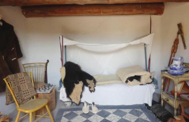 Sleeping quarters for the occasional ecotourists—dudes from the East and Europe who wanted to see the West while it was still wild.
 -
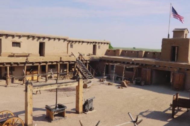 The large patio was the scene of gatherings at rendezvous, the annual celebration of a successful hunting and trapping season.
 -
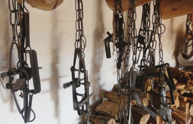 Traps were sometimes broken or lost. Where could a trapper find a replacement within 800 miles or so?
 -
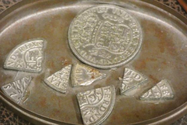 Spanish pieces-of-eight was the common currency, but most of the trade was straight up barter—pelts and hides in exchange for supplies and manufactured goods.
A WALK IN THE PARK
by LeMoyne Mercer
WHEN SHIRLEY AND I ARE HEADED to northern New Mexico and southern Colorado, we typically take I-70 and angle off southwest at Limon for Colorado Springs. From the Garden of the Gods, I-25 runs south to Walsenburg where we might turn west on Rt. 160 for the spectacular drive over Wolf Creek Pass, way up on the Great Divide, or continue down I-25 before turning into the mountains around Santa Fe.
Last year, we avoided the crowds and traffic on I-70 by taking an alternate route because of COVID and the disconcerting level of civil unrest in St. Louis. “Social distancing,” for whatever reason, is but one of the many benefits of RVing. We went through Kentucky to Land Between the Lakes and then west on Rt. 60/400 to The Middle of Nowhere before turning south. Frankly, though we took secondary roads, and sometimes just county roads, I regret not going that way before. There was much less traffic, and the roadways are in excellent condition because there are far fewer heavy trucks.
Some RVers, and a few other travelers as well, steer clear of interstates altogether as a matter of principle. They call it “shunpiking,” a term that comes from the practice of frugal people who avoid tolls by seeking alternatives to turnpikes. Embarrassed shunpikers sometimes claim it is not about the money. It’s the more leisurely pace and the chance to visit small towns with quaint stores and home-cooking restaurants instead of the chain Burger Doodles. Sikeston, MO, for example, is “Home of the Throwed Rolls.” When you say, “Pass the bread, please,” they take you literally. Usually with a tight spiral to your back shoulder.
Shunpikers find value in the chance to see The World’s Largest Farm Implement or visit the Barbed Wire Museum. This year, we paused for a while in the eensie-teensie village of Mullinville, KS when we spotted about 200 welded iron sculptures in a field along the road. One of the locals was busy adding even more. He said an area farmer had made them. “When the old man passed away, we decided to erect a ‘museum’ in his honor,” he said. They didn’t form a committee or hire consultants to get a government arts grant. They just did it. (Villagers in Kansas have no idea about how you are supposed to go about these things.) Some of the sculptures were fairly traditional, but others were decidedly idiosyncratic. In other words, art.
Unexpected encounters like this are but one of the reasons we repeated the route. A fairly representative journal entry says, “Easy driving with light traffic all day. Minor delay at Paduka because the street sign at Kennedy and Lone Oak was twisted around backwards so we ended up in a residential neighborhood.” So, a few minutes of inconvenience in exchange for a whole day of easy driving.
In the Ozark Mountains of Missouri, the highway makes steep, winding descents into broad valleys. It disappears into the trees as it curves and then re-emerges higher up the far slope, disappears again, and reappears near the crest of the far ridge. By the time you reach southern Kansas and Southeastern Colorado, the Ozarks have settled down into high plains—until farther on the real mountains bang their heads on the sky. Millions of acres of wheat gently undulate all the way to the horizon. Barely visible in the distance are gray-green blips where farmers and ranchers have planted dense groves of trees around their houses and outbuildings for wind breaks in winter and shade in summer. Interspersed with the wheat are millions of acres of vivid green, irrigated alfalfa and timothy hay fields. (Not related to the kid in Little Rascals or the friend of St. Paul.) These varieties provide extra protein, fiber, vitamins, and minerals for horses and millions of tons of Black Angus steaks on the hoof. That’s why butchers tout their “grass-fed beef.” It is considered a premium product with more omega-3 fatty acids and no antibiotics, steroids, or growth enhancers. In the West, free-range steers often come to our campsites to say, “Thanks for having us over for supper.”
But I digress.
To live up to shunpikers’ reputation for frugality, we stayed at Corps of Engineers campgrounds at Land Between the Lakes, KY and Wichita, KS. The COE offers well-designed facilities with water and electricity at widely spaced campsites. Electricity can be especially important if you want to run your RV AC when temps are 90+. With the senior pass, good at all federal recreation areas, camping is half off. We paid $12 and $9 respectively. There is also a city park at Lakin in far Southwestern Kansas that charges only $10 for sites with water and electricity. Not that shunpikers are necessarily parsimonious. Not exclusively, anyway.
At La Junta, CO there are three forks in the road, so you can choose to head to Pueblo, Walsenburg, or Trinidad. Or, you can stop at Bent’s Old Fort National Historic Site, which is there because it is at a historic crossroads on the Santa Fe Trail. The fort was established in 1833 on the banks of the Arkansas River as a trading post by Charles and William Bent and their business partner Ceran St.Verain. At the time, the river was the boundary between the US and Mexico as a result of Jefferson’s Louisiana Purchase.
I thought it was called “Old Fort” because 1833 was quite a while ago. As it turns out, the name was to distinguish it from their “New Fort,” built in 1853 near Lamar, CO a few miles farther downstream. The Bents and St. Verain also owned Fort St. Verain to the north and Fort Adobe to the south as well as stores in Santa Fe and Taos. The partners built up an extensive mercantile enterprise that attracted mountain men with beaver pelts and Indians who had buffalo hides to trade for manufactured goods, supplies, and various colorful gimcracks and do-dads. Way out there on the plains, the Fort was an improbable center of international trade featuring goods from Mexico, Europe, and Asia as well as the Eastern US.
The fort was respected as neutral territory even by warlike Comanches. Rendezvous, the traditional annual gatherings of trappers, traders, and Indians, were great opportunities for celebrating a successful hunting season with a fandango—music, dancing, and assorted games and contests.
The fort also functioned as a self-sufficient town, providing services as well as supplies. The 60 residents included blacksmiths, wheelwrights, carpenters, gunsmiths, and merchants. It was the only place along the 800 miles between Independence, MO and Santa Fe where travelers could get their wagons repaired and their supplies replenished. Prices undoubtedly reflected that supply-demand imbalance. The smiths and other craftsmen salvaged what they could from fatally damaged wagons and other equipment in order to recycle it into repairs for their clientele.
Eventually, though, the Bents were victims of their own success. Because of its strategic location, the site was chosen by the US Army as a staging point for the Mexican War. Gen. Stephen Kearney arrived with 1,650 dragoons (mounted soldiers) and a long train of government wagons. All those saddle horses, pack horses, and draft animals overgrazed the area around the fort and fouled the water sources. The war gained New Mexico for the US but, in the process, destroyed the Bents’ trading partnership with Old Mexico. The presence of so many soldiers also made the Indians a little nervous about hanging around, so there was the loss of valuable buffalo robes as well. Another unfortunate development was a cholera epidemic that was particularly devastating for the Indians who were genetically less resistant. As a result of all these factors, the Old Fort was abandoned and then burned down. Hence the New Fort that is now a state park.
One of our reasons for visiting the Old Fort this year is the Bicentennial of the Santa Fe Trail. Besides, the highway generally follows the route of the Trail, so we might as well stop. Celebratory activities include a three-day symposium with speakers plus special tours and Living History demonstrations. The Old Fort is where frontiersman Kit Carson worked for the Bents as a hunter and where explorer John Fremont had a base camp.
Bent’s Old Fort, called “The Castle of the Plains,” was not preserved but reconstructed as a National Historic Site in 1976 based on archeological evidence, paintings, drawings, and diaries. Chief among these were the careful measurements and drawings by Lt. James Abert. He was an army topographical engineer who was there in 1846 with Gen. Kearny but left behind because he came down with a fever. Abert noted that the adobe walls were 135 ft. x 180 ft. x 15 ft. high and 4 ft. thick with bastions in the northwest and southeast corners where swivel cannons were mounted and loop holes were provided for musketry.
The Bents had been impressed by the adobe architecture of Santa Fe, so they hired Mexican brick makers to construct their fort. Plastered over with more adobe, the façade was reasonably durable in the dry climate. (Plasterers were busy making repairs while we were there.) Around the central patio are two levels of living quarters and workshops—11 on the ground floor and five more on the upper level.
Though a civilian establishment, it actually was a fort because, as the greatest concentration of wealth in the region, it could have been the target for marauders of various kinds. Fortunately, the cannons of the fort were used exclusively to signal the arrival of parties on the Trail and were never fired in anger.
Much of the credit for this goes to William Bent who was born in St. Louis in 1809 and spent most of his life as a trapper and trader in the West. The Cheyenne called him Little White Man and respected him for his fairness as a trader. (It seems to me they could have shown their respect by choosing a more flattering ethnic name.) Besides, his wife, Owl Woman, was a daughter of Cheyenne chief White Thunder with whom he had four children. With Owl Woman, not the chief. After her death in the cholera epidemic, Bent married her sisters Island and Eagle Woman, with whom he had another child. Bent had special quarters at the Fort, but he also lived with his extended Cheyenne family in their village. In turn, the Cheyenne sometimes relocated entire villages close to the Fort.
The Fort itself reflected the multicultural and multiracial reality represented by William Bent and Owl Woman. Resident craftsmen, trappers, and traders spoke English, Spanish, French, and four Indian languages—Cheyenne, Arapahoe, Kiowa, and Comanche. There was plenty of fraternization going on. A special Council Room was set aside where Indian chiefs could settle disputes and agree on the terms of trade. In 1835, for example, it was the site of the peace council between the Cheyenne and Arapaho with their old enemies the Pawnee. Later, there were several more such intratribal councils at the fort because of Bent’s reputation as a peacemaker.
Meanwhile, brother Charles managed company operations in Taos and made seasonal trips back to the Fort. Eventually he married into a prominent Taos family and was appointed Provisional Governor of New Mexico. In that capacity, he was killed during an uprising of Mexicans and Pueblo Indians.
From Bent’s Old Fort we continued to Taos and then Santa Fe. The easy, air-conditioned drive through magnificent mountain scenery gave us an even greater appreciation for the patience and endurance of the people who settled the West. Crossing the endless miles of rolling plains was one kind of challenge, but getting to Taos and Santa Fe hauling heavy loads over those mountain passes was something else again. Traveling for eight to ten weeks from Missouri to Santa Fe in the 1830s was certainly no walk in the park.
LeMoyne Mercer is the travel editor for Healthy Living News. There is limited space here for LeMoyne’s photos. You might want to see more at anotherwalkinthepark.blogspot.com. Please leave comments on the site.